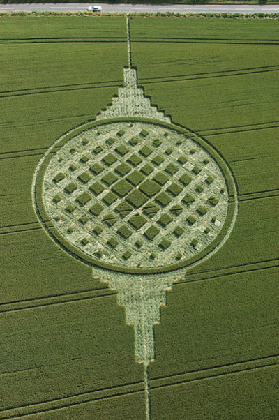
Photo by Steve Alexander, Crop Circle Archives (Crop Circle Connector)
- Date
- 20 June 2005
- Place
- Stephen's Castle Down, near Corhampton
- County or region
- Hampshire
- Country
- England
- Crop
- Wheat
- GPS
- 50.99423, -1.20271
- OS grid reference
- SU 560 219
- Nearest ancient site
- Danebury Hillfort, 28.3 km
- Reference codes
- LP-CCDB uk2005as
Photos17
Photos load from the archives that published them and remain the copyright of their photographers. Crop circle images and reports courtesy The Crop Circle Connector (cropcircleconnector.com). All sources and credits.
Reports
Crop Circle Archives (Crop Circle Connector)
Crop Circle at Stephen's Castle Down, nr Corhampton, Hampshire. Reported 20th June 2005 Stephen's Castle Down, nr Corhampton, Hampshire. Reported 20th June. Map Ref: SU560219 Updated Saturday 6th August 2005 The last time a crop circle appeared in this location was in 2000 . Image Steve Alexander Copyright 2005 On…
Photos by Steve Alexander, Lucy Pringle, Laurence Winram, Nathan Blake, Herb P Miller. Read the full report at Crop Circle Archives (2 pages).
Lucy Pringle Crop Circle Photography
An elaborate design containing multiple standing squares within a large ring An elaborate design containing multiple standing squares within a large ring
Photos by Lucy Pringle. Read the full report at Lucy Pringle.