Crop Circle Archives (Crop Circle Connector)
- Date
- 17 July 2005
- Place
- Sheep Pond Lane, near Droxford
- County or region
- Hampshire
- Country
- England
- Crop
- Wheat
- GPS
- 50.96779, -1.15190
- OS grid reference
- SU 596 190
- Nearest ancient site
- Danebury Hillfort, 32.9 km
Photos9
Photos load from the archives that published them and remain the copyright of their photographers. Crop circle images and reports courtesy The Crop Circle Connector (cropcircleconnector.com). All sources and credits.
Reports
Crop Circle Archives (Crop Circle Connector)
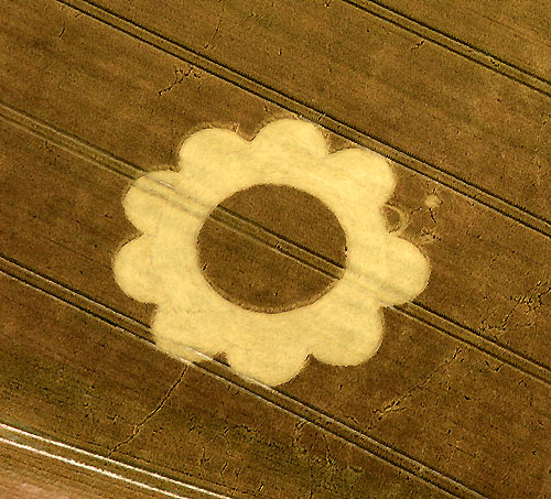
Crop Circle at Sheep Pond Lane, Nr Droxford, Hampshire. Reported 17th July 2005 Sheep Pond Lane, Nr Droxford, Hampshire. Reported 17th July. Map Ref: SU596190 Updated Thursday 21st July 2005 Images CCC Copyright 2004 Click on thumbnails to enlarge Images CCC Copyright 2005 Images Gareth Attrill Copyright 2004…
Photos by Gareth Attrill. Read the full report at Crop Circle Archives.