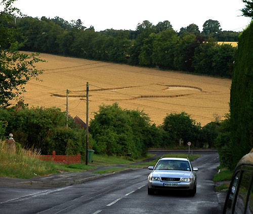
Photo by Lawrie Matthaus, Crop Circle Archives (Crop Circle Connector)
- Date
- 20 July 2005
- Place
- Kings Worthy, near Winchester
- County or region
- Hampshire
- Country
- England
- Crop
- Wheat
- GPS
- 51.09559, -1.30522
- OS grid reference
- SU 487 331
- Nearest ancient site
- Danebury Hillfort, 16.8 km
- Reference codes
- LP-CCDB uk2005bv
Photos13
Photos load from the archives that published them and remain the copyright of their photographers. Crop circle images and reports courtesy The Crop Circle Connector (cropcircleconnector.com). All sources and credits.
Reports
Crop Circle Archives (Crop Circle Connector)
Crop Circle at Kings Worthy, near Winchester, Hampshire. Reported 20th July 2005 Kings Worthy, near Winchester, Hampshire. Reported 20th July. Map Ref: SU487331 Updated Tuesday 25th April 2006 Image Lucy Pringle Copyright 2005 Image Lawrie Matthaus Copyright 2005 Diagram Alex Copyright 2005 Here some diagrams of…
Photos by Lucy Pringle, Lawrie Matthaus, Alex. Read the full report at Crop Circle Archives.
Lucy Pringle Crop Circle Photography
A very rough looking pattern, possibly intended to be the logo of the new X-Box?
Photos by Lucy Pringle. Read the full report at Lucy Pringle.