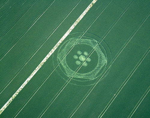
Photo by Nick Nicholson and the Crop Circle Connector, Crop Circle Archives (Crop Circle Connector)
- Date
- 15 June 2003
- Place
- Clifford's Hill, near All Cannings
- County or region
- Wiltshire
- Country
- England
- GPS
- 51.36613, -1.87721
- OS grid reference
- SU 0864 6301
- Nearest ancient site
- Alton Barnes White Horse, 2.0 km
- Reference codes
- LP-CCDB uk2003ap
Photos6
Photos load from the archives that published them and remain the copyright of their photographers. Crop circle images and reports courtesy The Crop Circle Connector (cropcircleconnector.com). All sources and credits.
Reports
Crop Circle Archives (Crop Circle Connector)
Crop Circle at Clifford's Hill, All Cannings, Wiltshire. Reported 15th June 2003. Clifford's Hill, All Cannings, Wiltshire. Reported 15th June. Map Ref: SU08646301 Updated Sunday 22nd June 2003 Image Nick Nicholson and the Crop Circle Connector Copyright 2003 Images Copyright www.temporarytemples.co.uk 2003 Diagram…
Photos by Nick Nicholson and the Crop Circle Connector, Bertold Zugelder, Busty Taylor. Read the full report at Crop Circle Archives.
Lucy Pringle Crop Circle Photography
A circular ring with a hexagonal outer path, surrounded by two thinner rings. A small circle in the middle of the formation is surrounded by six satellite circles, also in a hexagonal design
Photos by Lucy Pringle. Read the full report at Lucy Pringle.