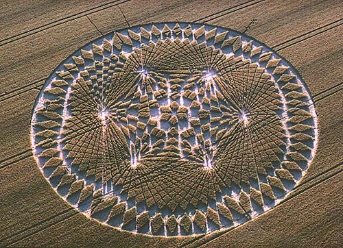
Photo by Steve Alexander, Crop Circle Archives (Crop Circle Connector)
- Date
- 18 July 2002
- Place
- Windmill Hill, near Avebury
- County or region
- Wiltshire
- Country
- England
- Crop
- Wheat
- Reference codes
- LP-CCDB uk2002br
Photos12
Photos load from the archives that published them and remain the copyright of their photographers. Crop circle images and reports courtesy The Crop Circle Connector (cropcircleconnector.com). All sources and credits.
Reports
Crop Circle Archives (Crop Circle Connector)
Crop circle at Windmill Hill, nr Avebury, Wiltshire. Reported 18th July 2002 Windmill Hill, nr Avebury, Wiltshire. Reported 18th July. Map Ref: GPS Updated Sunday 4th August 2002 Images Steve Alexander Copyright 2002 Image Colin Andrews www.CropCircleInfo.com Copyright 2002 Image Stuart Dike Copyright 2002 Image…
Photos by Steve Alexander, www.CropCircleInfo.com, Stuart Dike, Andrew King, Bertold.Zugelde. Read the full report at Crop Circle Archives.
Lucy Pringle Crop Circle Photography
A complex design similar to the magnetic field formation of 1999 but based around a six-fold geometry A complex design similar to the magnetic field formation of 1999 but based around a six-fold geometry
Photos by Lucy Pringle. Read the full report at Lucy Pringle.