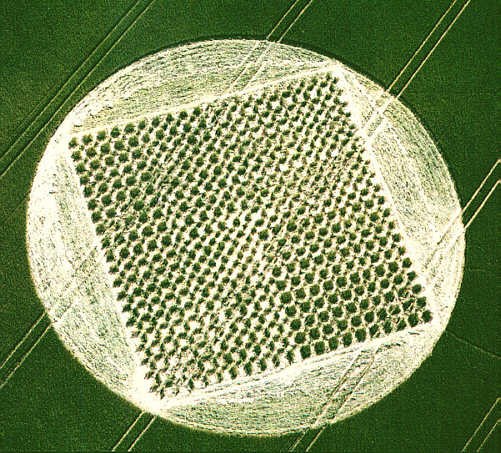
Photo by Steve Alexander, Crop Circle Archives (Crop Circle Connector)
- Date
- 2 July 2000
- Place
- East Kennett, near Avebury
- County or region
- Wiltshire
- Country
- England
- Crop
- Wheat
- GPS
- 51.40727, -1.84231
- OS grid reference
- SU 1106 6759
- Nearest ancient site
- West Kennet Long Barrow, 0.6 km
- Reference codes
- LP-CCDB uk2000bn
Photos15
Photos load from the archives that published them and remain the copyright of their photographers. Crop circle images and reports courtesy The Crop Circle Connector (cropcircleconnector.com). All sources and credits.
Reports
Crop Circle Archives (Crop Circle Connector)
East Kennett, nr Avebury, Wiltshire. Reported 2nd July. ContentZone East Kennett, nr Avebury, Wiltshire. Reported 2nd July. GPS Reference SU11066759 Updated Thursday 13th July 2000 Image Steve Alexander Copyright 2000 After searching around the World Wide Web I think I have finally discovered what this formation…
Photos by Steve Alexander, Peter Sorensen, Stuart Dike, M.J.Fussell. Read the full report at Crop Circle Archives.
Lucy Pringle Crop Circle Photography
A very complex (and impressive) looking grid of squares. 1600 squares are formed giving the impression of a woven effect A very complex (and impressive) looking grid of squares. 1600 squares are formed giving the impression of a woven effect
Photos by Lucy Pringle. Read the full report at Lucy Pringle.