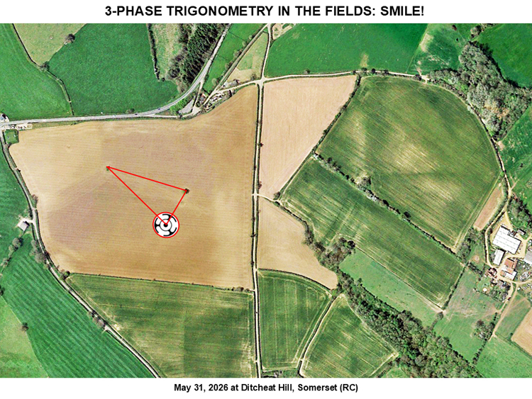
Photo by ukcropcircles, Crop Circle Connector
- Date
- 31 May 2026
- Place
- Circle at Ditcheat Hill, near Pylle
- County or region
- Somerset
- Country
- England
- Crop
- Wheat
- Size
- 120ft in diameter
- GPS
- 51.13086, -2.54558
- OS grid reference
- ST 61920 36984
- Nearest ancient site
- Glastonbury Tor, 10.8 km
Photos16
Photos load from the archives that published them and remain the copyright of their photographers. Crop circle images and reports courtesy The Crop Circle Connector (cropcircleconnector.com). All sources and credits.
Reports
Crop Circle Connector
Circle at Ditcheat Hill. Nr Pylle, Somerset. Reported 31st May 2026 Ditcheat Hill. Nr Pylle, Somerset. Reported 31st May 2026 Map Ref: ST6192036984 This Page has been accessed Updated Friday 5th June 2025 Here comes the legendary “horned serpent”, using a brushless, 3-phase DC motor! Here he comes. SMILE! (look…
Photos by ukcropcircles. Read the full report at Crop Circle Connector.
Temporary Temples
This crop circle was first reported on the 31st of May 2026 in a field of young wheat. It measures approximately 120ft in diameter. This is the first crop circle of 2026 to appear in wheat. This crop circle is a three-fold design. It’s geometry and design are quite uneven. But it can be approximated with compass…
Photos by Billy Breen and Tomasz Kaczmarek. Read the full report at Temporary Temples.