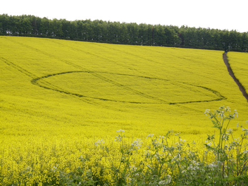
Photo by Craig Trelford, Crop Circle Archives (Crop Circle Connector)
- Date
- 10 May 2008
- Place
- Ashdown House, near Ashbury
- County or region
- Oxfordshire
- Country
- England
- GPS
- 51.55018, -1.59370
- Nearest ancient site
- Wayland's Smithy, 1.8 km
Photos6
Photos load from the archives that published them and remain the copyright of their photographers. Crop circle images and reports courtesy The Crop Circle Connector (cropcircleconnector.com). All sources and credits.
Reports
Crop Circle Archives (Crop Circle Connector)
Crop Circle at Ashdown House, Ashbury, Oxfordshire. Reported 10th May 2008. Ashdown House, Ashbury, Oxfordshire. Reported 10th May. Map Ref: Google Updated Thursday 15th May 2008 AERIAL SHOTS GROUND SHOTS DIAGRAMS FIELD REPORTS ARTICLES Spotted this one this morning, it appeared overnight. Its on the B4000 between…
Photos by Craig Trelford, Janet Ossebaard. Read the full report at Crop Circle Archives.