Photos load from the archives that published them and remain the copyright of their photographers. Crop circle images and reports courtesy The Crop Circle Connector (cropcircleconnector.com). All sources and credits.
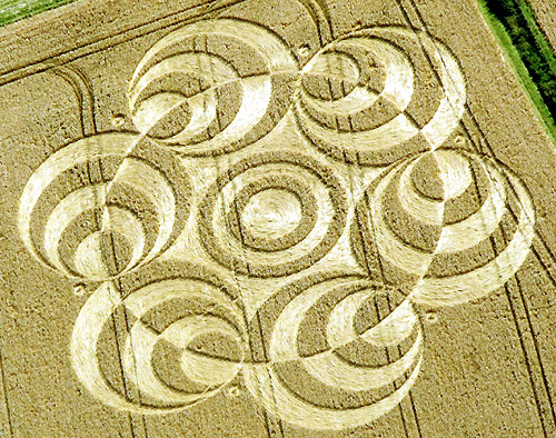
Crop Circle at Westwoods (3), Nr Marlborough, Wiltshire. Reported 9th August 2007. Westwoods (3), Nr Marlborough, Wiltshire. Reported 9th August. Map Ref: SU162673 This Page has been accessed Updated Wednesday 15th August 2007 AERIAL SHOTS GROUND SHOTS DIAGRAMS FIELD REPORTS ARTICLES Image John Montgomery Copyright…
Photos by John Montgomery, Philippe Ullens, Steve Alexander, Lucy Pringle, Frank Laumen, Tamara Breuning, Bertold Zugelder. Read the full report at Crop Circle Archives (2 pages).