Photos load from the archives that published them and remain the copyright of their photographers. Crop circle images and reports courtesy The Crop Circle Connector (cropcircleconnector.com). All sources and credits.
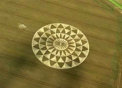
Crop Circle at Martinsell Hill, nr Oare, Wiltshire. Reported 19th July 2007. Martinsell Hill, nr Oare, Wiltshire. Reported 19th July. Map Ref: This Page has been accessed Updated Monday 8th October 2007 AERIAL SHOTS GROUND SHOTS DIAGRAMS FIELD REPORTS ARTICLES Amazing Coincidence or Synchronicity? At first glance…
An elaborate design comprising four rings of segmented petals forming a large 'sunflower' type design An elaborate design comprising four rings of segmented petals forming a large 'sunflower' type design