Crop Circle Archives (Crop Circle Connector)
- Date
- 5 June 2005
- Place
- The Firs, near Beckhampton
- County or region
- Wiltshire
- Country
- England
- Crop
- Wheat
- GPS
- 51.41239, -1.88962
- OS grid reference
- SU 07773 68158
- Nearest ancient site
- Silbury Hill, 2.3 km
- Reference codes
- LP-CCDB uk2005aj
Photos19
Photos load from the archives that published them and remain the copyright of their photographers. Crop circle images and reports courtesy The Crop Circle Connector (cropcircleconnector.com). All sources and credits.
Reports
Crop Circle Archives (Crop Circle Connector)
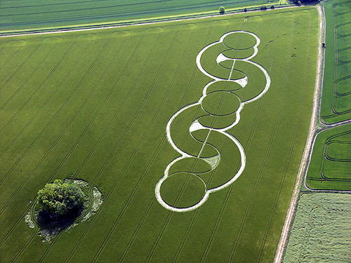
Crop Circle at The Firs, Nr Beckhampton, Wiltshire. Reported 5th June 2005 The Firs, Nr Beckhampton, Wiltshire. Reported 5th June Map Ref: APPROX SU0777368158 Updated Friday 1st July 2005 Images CCC Copyright 2005 Image Lucy Pringle Copyright 2005 Image CCC Copyright 2005 IMPORTANCE NOTICE The Farmer Peter Horton…
Photos by Lucy Pringle, Steve Alexander, Chris Watts, Ward. Read the full report at Crop Circle Archives.
Lucy Pringle Crop Circle Photography
A sequence of overlapping circles A sequence of overlapping circles
Photos by Lucy Pringle. Read the full report at Lucy Pringle.