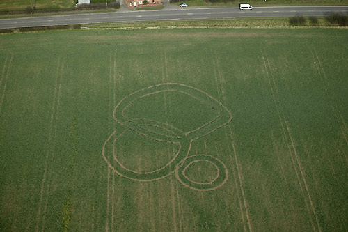
Photo by Chris Watt, Crop Circle Archives (Crop Circle Connector)
St Catherine's Well, Loversall nr Doncaster
19 April 2005, oilseed rape, 10 photos
- Date
- 19 April 2005
- Place
- St Catherine's Well
- County or region
- Loversall nr Doncaster
- Crop
- Oilseed Rape
- GPS
- 53.47526, -1.15096
- OS grid reference
- SK 564 979
- Nearest ancient site
- Rollright Stones, 169.1 km
Photos10
Photos load from the archives that published them and remain the copyright of their photographers. Crop circle images and reports courtesy The Crop Circle Connector (cropcircleconnector.com). All sources and credits.
Reports
Crop Circle Archives (Crop Circle Connector)
Crop Circle at St Catherine's Well, Loversall nr Doncaster. Reported 19th April 2005 St Catherine's Well, Loversall nr Doncaster. Reported 19th April. Map Ref: SK564979 Updated Thursday 1st September 2005 NEWS RELEASE From Business Link South Yorkshire Contact: Amrit Saroya Date: 8 th April 2005 FARMER’S LANDMARK…
Photos by Chris Watt, Dave Strickland. Read the full report at Crop Circle Archives.