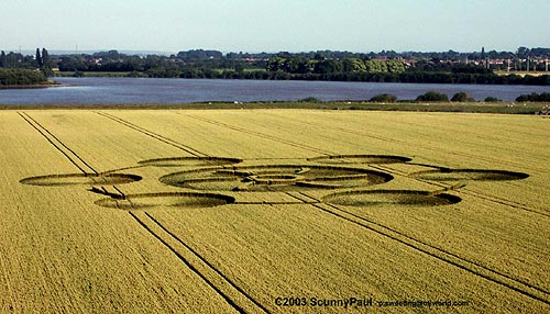
Photo by Scunny Paul, Crop Circle Archives (Crop Circle Connector)
- Date
- 9 July 2003
- Place
- Howdendyke, near Howden
- County or region
- Yorkshire
- Country
- England
- Crop
- Wheat
- GPS
- 53.73088, -0.86691
- OS grid reference
- SE 748 266
- Nearest ancient site
- Rollright Stones, 200.8 km
Photos2
Photos load from the archives that published them and remain the copyright of their photographers. Crop circle images and reports courtesy The Crop Circle Connector (cropcircleconnector.com). All sources and credits.
Reports
Crop Circle Archives (Crop Circle Connector)
Crop Circle at Howdendyke, nr Howden, Yorkshire. Reported 9th July 2003. Howdendyke, nr Howden, Yorkshire. Reported 9th July. Map Ref: SE748266 Updated Friday 18th July 2003 Image Scunny Paul Copyright 2003 Diagram Bertold Zugelder Copyright 2003 http://www.cropcircle-archive.com Location: M62 westbound junction 37…
Photos by Scunny Paul, Bertold Zugelder. Read the full report at Crop Circle Archives.