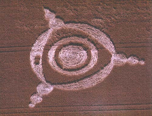
Photo by Alexander, Crop Circle Archives (Crop Circle Connector)
- Date
- 1 July 2002
- Place
- Liss, near Peterfield
- County or region
- Hampshire
- Country
- England
- Crop
- Barley
- GPS
- 51.03736, -0.90378
- OS grid reference
- SU 76957 27016
- Nearest ancient site
- Chanctonbury Ring, 39.8 km
- Reference codes
- LP-CCDB uk2002ax
Photos7
Photos load from the archives that published them and remain the copyright of their photographers. Crop circle images and reports courtesy The Crop Circle Connector (cropcircleconnector.com). All sources and credits.
Reports
Crop Circle Archives (Crop Circle Connector)
Crop circle at Liss, nr Peterfield, Hampshire. Reported 1st July 2002 Liss, nr Peterfield, Hampshire. Reported 1st July. Map Ref: GPS SU76957 27016 Updated Monday 30th July 2002 Image Steve Alexander Copyright 2002 Images Richard Harrison Copyright 2002 I have to inform you that a crop circle has been discovered in…
Photos by Alexander, Richard Harrison. Read the full report at Crop Circle Archives.
Lucy Pringle Crop Circle Photography
A 3 ringed circle with 3 lots of 3 diminishing circles going out from it. The outer ring is anti-clockwise and all the rest is clockwise. There were two small circles of standing crop in the outer ring
Photos by Lucy Pringle. Read the full report at Lucy Pringle.