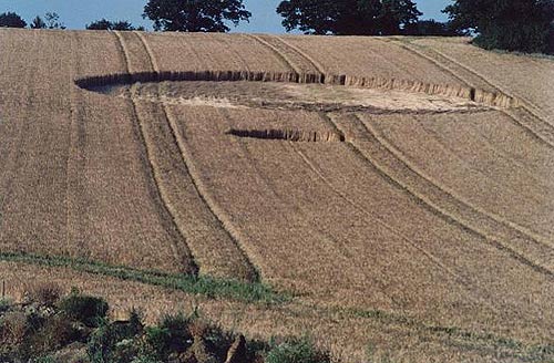
Photo by Graham Tucker, Crop Circle Archives (Crop Circle Connector)
- Date
- 27 June 2002
- Place
- High Halden, near Ashford
- County or region
- Kent
- Country
- England
- Crop
- Barley
- GPS
- 51.10823, 0.72209
- OS grid reference
- TQ 906 378
- Nearest ancient site
- Long Man of Wilmington, 50.0 km
Photos2
Photos load from the archives that published them and remain the copyright of their photographers. Crop circle images and reports courtesy The Crop Circle Connector (cropcircleconnector.com). All sources and credits.
Reports
Crop Circle Archives (Crop Circle Connector)
Crop circle at High Halden, nr Ashford, Kent, Reported 27th June 2002. High Halden, nr Ashford, Kent, Reported 27th June. Map Ref: GPS TQ906378 Updated Sunday 30th June 2002 Take an air experience over the crop circles Image Graham Tucker Copyright 2002 Reported by Gordon Clark of the Kent Dowser Group on the 27th…
Photos by Graham Tucker. Read the full report at Crop Circle Archives.