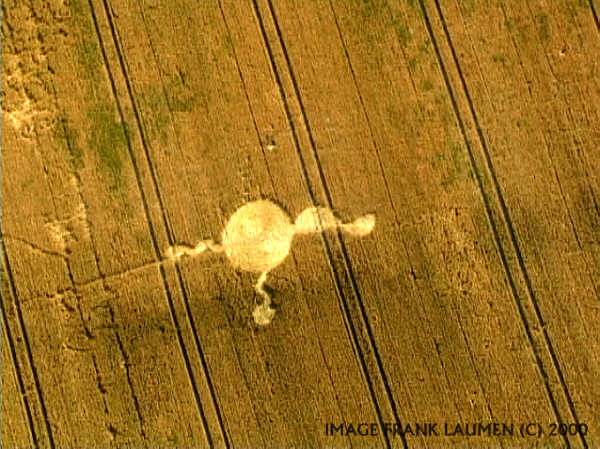
Photo by Laumen, Crop Circle Archives (Crop Circle Connector)
- Date
- 27 July 2000
- Place
- Rough Down, near Marlborough
- County or region
- Wiltshire
- Country
- England
- GPS
- 51.43714, -1.74697
- OS grid reference
- SU 1768 7093
- Nearest ancient site
- Hackpen White Horse, 5.7 km
Photos12
Photos load from the archives that published them and remain the copyright of their photographers. Crop circle images and reports courtesy The Crop Circle Connector (cropcircleconnector.com). All sources and credits.
Reports
Crop Circle Archives (Crop Circle Connector)
Rough Down, nr Marlborough, Wiltshire. Reported 27th July. ContentZone Rough Down, nr Marlborough, Wiltshire. Reported 27th July. GPS Reference SU17687093 Updated Friday 29th September 2000 Image Frank Laumen Copyright 2000 FIELD REPORT Video Image M.J.Fussell Copyright 2000 Click on thumbnails to enlarge. Images…
Photos by Laumen, M.J.Fussell, Stuart Dike & M.J.Fussell, Stuart Dike. Read the full report at Crop Circle Archives.