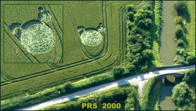
Photo by Peter Sorensen, Crop Circle Archives (Crop Circle Connector)
- Date
- 16 July 2000
- Place
- Stanton Bridge, near Stanton St Bernard
- County or region
- Wiltshire
- Country
- England
- GPS
- 51.35363, -1.86762
- OS grid reference
- SU 0931 6162
- Nearest ancient site
- Alton Barnes White Horse, 1.5 km
- Reference codes
- LP-CCDB uk2000cd
Photos10
Photos load from the archives that published them and remain the copyright of their photographers. Crop circle images and reports courtesy The Crop Circle Connector (cropcircleconnector.com). All sources and credits.
Reports
Crop Circle Archives (Crop Circle Connector)
Stanton Bridge, nr Stanton St Bernard, Wiltshire. Reported 16th July. ContentZone Stanton Bridge, nr Stanton St Bernard, Wiltshire. Reported 16th July. GPS Reference SU09316162 Updated Friday 21st July 2000 Image Peter Sorensen Copyright 2000 FIELD REPORT Click on thumbnails to enlarge. Images Stuart Dike &…
Photos by Peter Sorensen, Stuart Dike & M.J.Fussell, Janet Tucker (Medway Crop Circles). Read the full report at Crop Circle Archives.
Lucy Pringle Crop Circle Photography
A large circle with two smaller circles adjacent to it, resembling a 'teddy bear' head
Photos by Lucy Pringle. Read the full report at Lucy Pringle.