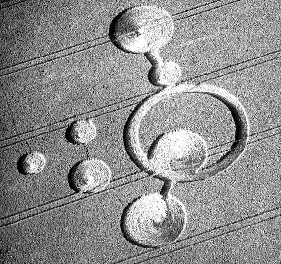
Photo by Phil Brookman, Crop Circle Archives (Crop Circle Connector)
- Date
- 18 June 2000
- Place
- Morcott, near Uppingham
- County or region
- Leicestershire
- Country
- England
- GPS
- 52.58199, -0.64431
- OS grid reference
- SP 9195 9910
- Nearest ancient site
- Rollright Stones, 92.3 km
Photos6
Photos load from the archives that published them and remain the copyright of their photographers. Crop circle images and reports courtesy The Crop Circle Connector (cropcircleconnector.com). All sources and credits.
Reports
Crop Circle Archives (Crop Circle Connector)
Morcott, nr Uppingham, Leicestershire. Reported 18th June CROP CIRCLES IN 2000 Morcott, nr Uppingham, Leicestershire. Reported 18th June. GPS Reference SP91959910 Updated Tuesday 18th October 2005 Images Phil Brookman Copyright 2000 The menu functions are disabled on the right mouse click. The EMCCCS have spent a…
Photos by Phil Brookman, Mark Haywood. Read the full report at Crop Circle Archives.